The Connecticut Post had an article regarding the Conservation Commission's award from the CFPA. I think it important to document recognition, and since the CtPost does not retain it's articles on the website for very long, I cut/paste for posterity.
http://www.connpost.com/localnews/ci_10456879
Shelton lauded for conservation efforts
By KATE RAMUNNI Staff writer
SHELTON -- The state's oldest private conservation association recently singled out the city's Conservation Commission and its Trails Committee for their efforts to preserve open space here.
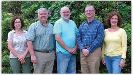
"We were really surprised" to receive the Connecticut Forrest and Parks Association's Award of Merit, said commission Chairman Tom Harbinson. The organizations received the award recently during the CFPA's annual meeting at the Kellogg Environmental Center in Derby.
For more than a century, CFPA has worked to preserve state properties and has been instrumental in the preservation of areas such as Sleeping Giant State Park in Hamden, Sherwood Island in Westport and Gillette Castle in East Haddam.
Each year it singles out an organization to recognize for its own preservation efforts, and this year that honor went to the two organizations for the formation of the Shelton Lakes Recreation Path.
"For their vision and perseverance in developing a townwide trail system for passive recreation -- the Shelton Lakes Greenway, 450-plus acres of contiguous open space and 10 miles of hiking trails -- is a direct result of their foresight, planning and collaboration with the Shelton Land Trust, the city of Shelton, Aquarion and the state Department of Environmental Protection, plus innumerable hours of volunteer work over a decade," the accolade states.
"I want to commend the volunteers of the Trail Committee, who have contributed a tremendous number of hours to this," Harbinson said.
The Board of Aldermen also deserved kudos for the millions of dollars it has spent and put before voters to bond for open space purchases, he said.
It's been a group effort, Trails Committee co-chairman Bill Dyer said. For instance, a recent appearance before the Inland Wetlands Commission looking for permission to do work on the Recreation Path at Lane Street resulted in Wetlands Commissioner Randy Szkola's offer to help with his construction equipment and manpower, Dyer said.
"They did a great job," he said.
Most people don't realize that the Recreation Path has been constructed wholly with grant money and volunteer labor, Harbinson said. They are always looking for people willing to contribute their time and talent -- and equipment, in the case of contractors -- to help with the most recent efforts that will make the entire path handicapped accessible.
Monday, September 15, 2008
Friday, September 12, 2008
Ct Forest and Parks Assocation Award to Shelton
 On Sep6, the Connecticut Forest and Parks Association presented an Award of Merit to the Shelton Conservation Commission and the Trails Committee in recognition of the work they have done over the years.
Specifically for “their vision and perseverance in developing a town-wide trail system for passive recreation. The Shelton Lakes Greenway – 450-plus acres of contiguous open space and ten miles of hiking trails – is a direct result of their foresight, planning, and collaboration with the Shelton Land Trust, the City of Shelton, Aquarion, and DEP, and innumerable hours of volunteer work over more than a decade. As part of this project they have created an open space corridor to link CFPA’s Blue-Blazed Paugussett Trail to the Shelton Lakes Greenway, and continue their invaluable effort to restore and extend the Paugussett Trail from Indian Well to the Stratford town line.”
CFPA maintains the 800-mile blue-blazed trail system in CT and is the oldest conservation organization in the state (http://www.ctwoodlands.org/).
The Paugussett Trail is a blue-blazed (sometimes referred to as blue-dot) trail in Shelton. At one time it connected from Monroe to Stratford, but development fragmented it to the current state of Monroe (the trail runs thru Web Mountain) connecting thru the "poets" section of town to the Indian Well State Park. You can check out it's local routing via the www.sheltontrails.org website.
The City's accumulation of land in a corridor format of the Shelton Lakes Greenway area (by following our Open Space Plan document) has allowed the creation of a trails network that can be utilized by the Paugussett trail to reconnect from Indian Well State Park toward Stratford's Roosevelt Forest.
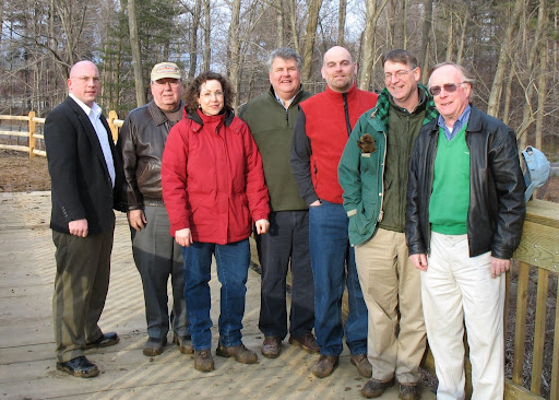
The CFPA gave a single Award of Merit this year, and speaking as the Chairman of the Conservation Commission, I thank them for the recognition, however it has been a team effort to reach the accomplishments achieved. The Board of Alderman, Planning & Zoning Commission, and Inland Wetlands Commission have been supportive of our goals and I thank them for that.
The Board of Alderman were made award of this award during their Sep11 mtg and gave a standing ovation in recognition to the Conservation Commission and especially the Trails Volunteers for all their hard work. Above is a scanned image of the recognition.
Thursday, August 28, 2008
Dog Park
The Shelton Weekly had an Aug11 article, the Huntington Herald had an Aug27 article and the Connecticut Post had a Jul22 article on the subject of a "dog park" in Shelton. The latter two articles are not available online for referencing (sadly, but that is another subject). Here are my thoughts on the matter.
First, it should be mentioned that all City of Shelton Open Space is open to dogs. This includes open fields and meadows (except those that are leased to farmers for agricultural crops), over 15miles of hiking trails, public spaces such as sports fields, and the riverwalk and veterans memorial park (slab) downtown. You can be a resident, visitor or employee in Shelton and access any of these locations freely for your enjoyment as there is no fee or license required (sports fields "use" may at times be managed and thus restricted). In addition to any state laws, there are some basic local requirements for your animals.
First, it should be mentioned that all City of Shelton Open Space is open to dogs. This includes open fields and meadows (except those that are leased to farmers for agricultural crops), over 15miles of hiking trails, public spaces such as sports fields, and the riverwalk and veterans memorial park (slab) downtown. You can be a resident, visitor or employee in Shelton and access any of these locations freely for your enjoyment as there is no fee or license required (sports fields "use" may at times be managed and thus restricted). In addition to any state laws, there are some basic local requirements for your animals.
- They must have a Dog License from the City. You can find out more regarding this via the Town Clerk's page of the City of Shelton website.
- Ordinance #799 from 2006/Aug/10, aka "Open Space Ordinance", item 16 states dogs must be leashed at all times while within the City Open Space areas.
- Ordinance #716 from 1997/Oct/9, aka "Pooper Scooper Ordinance", renders responsibility for removal of animals defications or face fine for violations.
Note: This free and open access is contrast to neighboring towns. Derby had a 6month dog ban on their Riverwalk, and Trumbull requires a license/permit for access and prohibits non-residents.
Second, awareness should be given as to the time-line on the current subject.
- Over the years of reviewing development applications, the Conservation Commission has heard residents request consideration for open space to walk their dogs. Notably on 2005/Aug/3, 2006/Dec/6. The concept of a "bark park" was discussed during preparation of the Open Space Plan, but only to the extent that such a possible use may be considered on City Open Space along with other uses such as farming, passive recreation activities, community gardens, etc. This was discussed over a year ago informally, and is noted in the draft of the City of Shelton Open Space Plan.
- On 2008/Jul/16, the Mayor met with two children (Adam and Alexis) who asked the Mayor to consider helping them gain permission to create a dog park in town (their dog's name is Bryce). They had already spoken to the "Dog Warden" (their reference, but Sheryl Taylor is actually the City of Shelton's Animal Control Officer) who thought it was a great idea. Specifically they referenced the Riverwalk area in downtown as desirable, but gave no reasoning for that.
On 2008/Jul/17, John Papa as Chairman of the Parks & Recreation Commission, and myself as Chairman of the Conservation Commission, received a memo from the Mayor's secretary asking that we "put together a committee to look into the feasibility of this request for a dog park in Shelton."
The subject has not been dismissed, but charter revision, little league championships, RecPath project logistics and simply our lives of vocation have been more pressing and delayed us giving our attention to the matter. Contrary to press reports, nothing has transpired since that date other than a brief and informal conversation between myself and John with the outcome that John would request that the Park & Rec staff research what other communities have offered (as example: Trumbull, Ridgefield, Norwich and Hamden have such off-leash and fenced boundary facilities).
There have been letters to the editor accounts from Alderman Jack Finn stating that the recently purchased property on Soundview Avenue would be a suitable location as it is "centrally located". Given that the parcel is currently and was purchased in part to continue it's use as agricultural property (corn, apples, grazing) that recomendation would require stronger evaluation. The Huntington Herald had a news article quoting John Papa as saying he didn't think downtown was suitable, and quoting Alderman John Anglace questioning the public demand for such an amenity.
Before any knee-jerk reactions cause poorly thought out decisions, there should be some evaluation of:
- public need - are they aware that all open space is available to them, is that satisfactory
- requirements - what size or kind of space, is water, fencing or other facilities needed
- operations impact - what is the cost
- location impact - would dogs congregating to bark be in harmony with quiet enjoyment of a residential area, does a location intended to serve public need geographic consideration.
Friday, August 15, 2008
Recreation Path - BOA appropriate funds
At the Thursday August 14th Regular Meeting of the Board of Aldermen, the final fiscal component was approved for the Phase 1 construction project to move forward. Contract preparation and execution is last hurdle before site work begins. The BOA appproval can be found on page 18 of their ThuAug14 BOA minutes.
Friday, August 08, 2008
Recreation Path - PZC released Trust Account funds
At the TueAug5 mtg of the Planninc & Zoning Commission, after a presentation from myself and co-chair Bill Dyer, and review by City Counsel of the trust fund documents, they voted to release the Huntington Woods Trust Fund (apx. $60k + $9k interest accrued). The balance of the LOCIP project should now come from allocation via the Board of Alderman. The Board of Alderman's next regular meeting is ThuAug14.
Today's CtPost had an update on our progress. I cut/paste here only for a record of the press documenting our activity, as the link's to the paper are not retained over time.
http://www.connpost.com/valley/ci_10133473
KATE RAMUNNI
Article Last Updated: 08/07/2008 11:32:57 PM EDT
SHELTON — Conservation officials are one step closer to their goal of upgrading the popular Shelton Lakes Recreation Path, buoyed by this week's Planning and Zoning Commission decision that directs money from the Huntington Woods Trust Fund to go toward the project.
The P&Z unanimously agreed to let the Conservation Commission tap into the almost $70,000 fund to make improvements to the path that connects downtown to Huntington Center. The upgrades will make the path easier to use, especially for those on bicycles and in wheelchairs, and mothers with baby strollers.
But the approval comes with an important caveat, Zoning Administrator Rick Schultz said.
"Now they have to show proof they can get the additional funding," he said, referring to the remaining portion of the $150,000 project price tag.
To that end, Conservation Commission members will meet today with Mayor Mark A. Lauretti to discuss the possibility of using Local Capital Improvement Program (LoCIP) funds for the work, the panel's chairman, Tom Harbinson, said.
"I meet with the mayor regarding the balance on Friday morning to work out the LoCIP logistics," Harbinson said.
Members of the Conservation Commission and its Trails Committee have worked for years to make the recreation path a reality. The 4.3-mile trail stretches from the Shelton High School and Shelton Intermediate School campus to Huntington Center. The area of the path by the schools is made of gravel and asphalt, while other sectionsare less developed.
The first phase of the project, which will cost about $153,000, will put a new surface on the path from Pine Lake to the intersection of Constitution Boulevard and Shelton Avenue.
Harbinson said he had approached Lauretti about getting the LoCIP funds and Lauretti suggested trying to get permission from the Planning and Zoning Commission to use the trust fund money for part of the project.
Developer Monty Blakeman established the fund about eight years ago when he built the Huntington Woods subdivision. The money was earmarked for improvements "in and around" Huntington Woods, but Corporation Counsel Tom Welch determined that the wording of the fund's description allowed for a use such as the recreation path.
Monday, August 04, 2008
Recreation Path - community effort
An article in the CtPost of Aug4 illustrates the volunteer efforts and community enthusiasm for the RecPath. It is of particular note, and in advance of the PZC decision on Aug5 to release funds toward the cause, that the area in the vicinity of HuntWoods shows significant involvement.
Sometimes the CtPost links go stale, so I offer the text for future reference:
http://www.connpost.com/localnews/ci_10088628
KATE RAMUNNI
SHELTON — An initiative by the Conservation Commission's Trails Committee to extend the city's Recreation Path through Lane Street is becoming a true community effort.
Committee members Terry Gallagher and Bill Dyer were surprised recently when their appearance before the Inland Wetlands Commission resulted in an offer from one commission member to help with the project.
Organizations such as the Girl Scouts have already put sweat equity into the project by cleaning up the targeted area.
Dyer told the wetlands commission that their goal is to make the 8-foot-wide gravel path accessible to both the handicapped and bicyclists. There are wetlands, including the Mean Brook, in that area, which is why the Trails Committee members appeared before the commission.
Two years ago, the Trails Committee and the Shelton Land Trust constructed a boardwalk there, Gallagher said, and the goal now is to extend that by about 8 feet. His daughter's Girl Scout troop spent time there pulling garbage out of the brook, Gallagher said.
Landscape architect James Swift also donated his time and talent to the project, Dyer said, as did surveyor Tracy Lewis.
The land where the trail will be extended is owned by the city and the land trust, he said.
Lane Street is one of the city's designated scenic roads and is lined with sugar maples, Gallagher said, and the work will take that into account and cause as little disruption as possible.
Wetlands commissioner Randy Szkola, who is a contractor, said he would be willing to lend his equipment and time to the project to help move boulders that need to be repositioned near the path.
"That was nice. We went there with our plans and came out with an offer of help," Conservation Commission Chairman Tom Harbinson said.
The Recreation Path has grown over the years and now spans from downtown to Huntington Center. The work is part of a larger project to widen the trail and make it more accessible.
"We want to make it accessible to bicycles and baby carriages," Dyer said.
Dyer and Harbinson recently went before the Planning and Zoning Commission to request using the Huntington Woods Trust Fund to pay for a portion of the $150,000 cost of the first phase. Developer Monty Blakeman established the $60,000 fund eight years ago when he built the Huntington Woods subdivision to be used for improvements in and around that area.
No decision has been made yet as to whether the funds will be allocated for the project.
Friday, July 18, 2008
Recreation Path - Phase 1 construction funding
There has been an article in the CtPost regarding the Conservation Commission's request to the Planning & Zoning Commission for release of moneys from a trust account they are custodians for and was funded during the subdivision process of property known as Huntington Woods. Kate Ramunni has done a good job of presenting the story. As is my custom, I cut/paste the article with additional information to help the public understand the subject more than can be explained within the confines of the newspaper.
First: the original CtPost's story's URL will become stale after a certain period of time, and then be available only via a pay/article type service.
http://www.connpost.com/localnews/ci_9915924
The CtPost article is below, with my additional comments bounded by ++ marks:
KATE RAMUNNI
Article Last Updated: 07/17/2008 10:38:12 PM EDT
SHELTON — A trust fund set up years ago by a developer may be used for a major project that will help improve and expand the city's Recreation Path.
In 2000, developer Monty Blakeman put $60,000 into the trust fund when his Huntington Woods 72-lot subdivision won Planning and Zoning Commission approval.
++ The trust account was required as part of the subdivision approval given by the Planning and Zoning Commission, and was funded via the subdivision applicant "Huntington Woods LLC", which is owned by Monty Blakeman. Commonly, developers form a legal entity (usually an Limited Liability Corporation) for each development. Mr Blakeman has performed with great success as both a developer (creator of subdivisions) and a builder (constructs residential and commercial structures) via various entities.++
The money was to be used to fund "other on-site and off-site improvements," according to Zoning Administrator Rick Schultz.
++ The subdivision regulations require that 10% of the raw land parcel's acreage be set aside as Public Open Space. In this development application's approval by the PZC, in addition to that land set-aside, and recognizing that there may be improvements needed once the development became built (it was done in 2 phases), the PZC required that $60k be set in trust for such improvements. Though not stated clearly in the minutes, it was generally understood that this would be for use in constructing the Recreation Path which would traverse the Open Space dedication as the general discussions on the subject during the approval process started with the developer constructing the RecPath with his equipment while preparing the site, then diminished to offering use of his equipment to do the construction, and finally dwindled to the money being set into trust for future improvements.++
Since then, the money has sat in the fund unused. But now the Conservation Commission is asking the P&Z for permission to use the money to partially fund a $150,000 project that would make the path accessible to the handicapped and to bicycle riders.
"We have been trying for many years to create a recreation path from Huntington Center to downtown Shelton, and we have made pretty good progress," said Conservation Commission Vice Chairman Bill Dyer, who also chairs the Trails Committee.
++ The RecPath is currently routed to run from Pine Lake near downtown, to Huntington Center. The highest intensity of use is expected near the school campus, police station, and senior center as it wraps around former public water reservoirs (now owned by the City, and no longer used for water supply). We concentrated on those areas, constructing timber bridges, preparing connections to trails for the SHS Cross Country Team, etc. Additionally, work has taken place on the Huntington end of the path with work by the Shelton Land Trust (a non-govt not for profit) which has facilitated the path through it's meadow off of Lane Street. There has been lots of progress.++
The work they want to do now would make the path between 8- and 12-feet wide and cover it with gravel that would allow for easier access for those on bicycles and in wheelchairs, he said.
The commission already has gone out to bid for the work, which came in at the $150,000 figure and would be done in three phases, Dyer said.
++ The RecPath is more than a hiking trail, it is designed to be a multi-use (walking, biking, etc) pathway. The design was completed for Phase 1 (Pine Lake, across Meadow Street, thru the School Campus, across ConstBlvd, on top of the dam, to the corner by Rte108 and ConstBlvd.), permitting was obtained from the Inland Wetlands Commission, co-ordination occurred via the Mayor's office, the Request for Quotations went out via the Purchasing Dept., bids were reviewed by the Conservation Commission and recomendation made to the Mayor's office. We are not yet on Phase 2 (Knell's Rock/Rte108 to Huntington Woods) but some work has taken place in the Phase 3 area (Huntington Woods to Huntington Center) in the area of Lane Street and privately by the Shelton Land Conservation Trust on their land off Lane Street where they have allowed the RecPath to traverse.++
Officials are looking into using Local Capital Improvement Program funds or other grant sources for the remaining $90,000, he said. When Dyer and chairman Thomas Harbinson met with Mayor Mark A. Lauretti about the project, it was Lauretti who suggested using the Huntington Woods Trust Fund to pay for part of the project, Dyer said. "He challenged us to come before you and ask for the money," he told the Planning and Zoning Commission this week. "We also will be looking for money from multiple pots."
++ LOCIP is a reimbursement program from the State of Ct. The project has to qualify for reimbursement (I confirmed that the RecPath does qualify via the Community Development Director who administrates the LOCIP program) and be within the limits of available funds (Shelton is allocated a threshold for LOCIP projects, and unused portions can be rolled over into a subsequent year - this is within the annual limits). The City should have a Capital Improvement Plan where it projects what projects and how much they cost will need to be undertaken, and where the money will come from. It does not seem to be a formally documented process, and thus the look for multiple funding sources++
The work won't be done near the Huntington Woods subdivision in the area of Bridgeport Avenue and Old Stratford Road, which led zoning commission Chairman Tony Pagoda to question whether the money could be used for that purpose. "I was under the impression that the money had to be used around Huntington Woods for the benefit of the people living there," he said. "Don't get me wrong — I think this is great, but I just want to make sure that the funds are used as they were intended to be used." There's been much volunteer time and effort invested in that area by the Conservation Commission and the Trails Committee, both Dyer and Harbinson said. "We have done a lot of work around there," Dyer said.
++ The timber bridge at Huntington Center, the preparation of the Lane Street as a RecPath location near the Scenic Lane Estates subdivision, the work co-ordinated with the Shelton Land Conservation Trust for a boardwalk construction across a stream near Lane Street, the work by the Land Trust via a grant from the Iroquois Gas company for the work on the Hawley Meadow parcel, Eagle Scout projects by Spencer Tate for timber bridge projects near Huntington Woods: ALL work in/near Huntington Woods.++
"Overall, this project benefits the residents of Huntington Woods and the entire community," Harbinson said.
++ Shelton is a community as a whole. I have at times encountered people who want to distinguish themselves as living in Huntington or White Hills, and that's fine for people looking to portray a certain cache, but to think that their is some greater ownership or entitlement to a trail or open space is a misunderstanding. There is certainly greater benefit and value to having a trail network within walking distance of your residence, but the project benefits the entire community and is offered to the entire community with full inclusion.++
Zoning Commissioner Patrick Lapera, who also is an attorney, said that the commission needs to be especially careful since the money was put into a trust. There must be a clear designation in the document that will allow it to be used for the recreation path, he said, adding that he would support it only if there is a guarantee that the rest of the project will be funded. "I would not be in favor of giving out this money unless you have in hand the other money," he said.
++ It will be up to the P&Z Administrator to research the trust document and consult with the City's Atty over available course of action. Unless we have complete funding, there is no Phase1 construction. The Conservation Commission has been carrying the baton on this leg of approvals and logistics planning, but ultimately the Board of Alderman as the governmental body in control of financial matters will have to make the decision in awarding and funding this capital project++
Tuesday, March 04, 2008
Soundview Avenue Open Space Purchase
The article in today's Ct. Post shows that it is worthwhile to note the full story and process that can't always be fit into a single article. The Ct.Post article hyperlinks are not retained a that static location forever, so while I include the link, cut/paste the article with my commentary.
http://www.connpost.com/localnews/ci_8443523
By KATE RAMUNNI
SHELTON — The 14 undeveloped acres on Soundview Avenue had been in the city's sights for years. But when the land went on the market last year, officials pounced — and missed.
Instead, the property was sold for $1.4 million to Huntington Development, a group in which Alvaro DaSilva is the principal. He is the longtime chairman of the Inland Wetlands Commission who stepped down from the panel effective last Saturday.
++ The property is 279 Soundview Avenue, uphill from the Meadow Street end. While the parcel is largely undeveloped, it would be better characterized as an oversize lot. There is a single residential structure with the balance of the property being primarily fields used for agriculture and some woodlands. It is within our Shelton Lakes Greenway area on our Open Space Plan. It is adjacent to property both acquired via subdivision regulations from the development of Summerfield Condos on Constitution Boulevard, and via purchase from the Wiacek family for their farm that reaches from this parcel to the SHS campus above the ballfields. ++
DaSilva's group later proposed building a subdivision on the site, a project that won land-use approval less than a year after the sale, and renders the land more valuable.
++ The subdivision of land was an "as-of-right" application for the R1 zone it was within. The PZC, IWC, City Engineer, and CC all reviewed the application that was approved. All of that is in the public domain to be aware of and view via minutes of the agencies. Naturally, after making that subdivision application's investment, the property's value rose with the availability of approved building lots rather than simply land.++
That chain of events, and the city's failure to act sooner, have come under criticism after the Board of Aldermen recently reached a deal to buy the tract for $2.1 million — giving Huntington Development a net profit of $724,000.
++ As mentioned above, there was additional investment of engineering, applications, etc. It is more than looking at land transfer sale amount listed in the paper, and profit= sale price A minus sale price B ++
"I don't know why Mayor [Mark] Lauretti didn't purchase it then when we always have a surplus," said Planning and Zoning Commission alternate Chris Jones. "This deal doesn't smell right." But Lauretti and other city officials said that the seller's insistence that the deal be completed immediately had doomed it from the start.
++ Chris was made aware of what transpired on this parcel, during the course of a PZC meeting where they gave a favorable 8-24 referral toward the acquisition. To characterize the deal as "smelly" post-awareness of that knowledge is unfortunate. ++
A year ago, then-owner Nellie Krynitzky put a "for sale" sign on her property, and Shelton Land Trust President Joe Welsh immediately contacted her, according to Conservation Commission Chairman Tom Harbinson. "She told Joe that she had already had a couple of people contact her," Harbinson said. "I called her that night and she said she was interested in selling, but wanted to sell it immediately." Less than a week after the sign went up, Krynitzky had five offers, Harbinson said. "I knew the city wouldn't have that much money in its pocket to come up with it quickly," he said. And then a short time later, he said, the sale to Huntington Development was finalized.
++ It is not appropriate for me to say what personal reasons Ms. Krynitzky may have had for selling her property, but I had spoken to her directly. She wanted it sold promptly and naturally for the best price. She had at least 5 parties that already had expressed interest within a week of placing the sign on her front lawn. From all the data I have at my disposal, the City reacted as promptly as it could.++
The city should have been able to come up with the money then, Jones said. "It's strange how the city didn't have a million dollars to buy it last year, but now it has $2.1 million," he said. "I don't like how this has flip-flopped."
++ The City is challenged to maneuver as fast as the private parites in the market place. There are approvals or authorizations that have to occur for anyone representing the City to make or negotiate an offer. There are times during the year when the City has ample cash-flow balances (Jun/Dec around tax collection) and other times when it is limited available cash balances ++
The property, located near the Shelton High School/Intermediate School campus, was on the commission's Quality of Life list, Harbinson said, and former commission chairwoman Harriet Wilbur had kept in contact with Krynitzky for years in anticipation that it would eventually be for sale. But there was no indication Krynitzky was going to suddenly sell it last March, Harbinson said. Krynitzky, who couldn't be reached for comment, continued to have others farm the land for corn and apples, he said. "We had no hint that she was going to sell," he said.
++ Pre-2006 Harriet had touched base with Nellie occasionally over the years regarding the City's interest in her parcel. It was farmed for hay and corn. On 2006/Oct/11 Nellie spoke to a person who is a friend of Conservation efforts in Shelton that she was considering selling her property. This was confided to me that evening. Not to long after that Nellie put a sign on her front lawn, which commissioner Joe Welsh saw while driving by and called the number listed. Joe related to me what their conversation covered, and I called her that very evening. I related all of this to the Mayor the following day.++
Once the sign went up, city officials also tried to contact Krynitzky, to no avail, Lauretti said. "She wouldn't return our calls," he said. A registered letter also went unanswered, he said. "We would have paid as much as anyone else," he said.
++ The City has always paid valuations that are transparant with appraisals for the property done by a third party. This is required by law, and is a fiduciary responsibility of the Board of Alderman whcih they have always conducted.++
About two weeks after Huntington Development bought the property, it filed an application with the Planning and Zoning Commission for an 11-lot subdivision, which the commission granted in June. The vote was unanimous, with Commissioner Leon J. Sylvester abstaining.
++ Commissioner's can abstain for any reason. Commissioner Sylvester's wife is a real-estate agent which may have been the reason in this case. It might not be determined as Roberts Rules of Order do not require anyone to state their reason for abstaining. If you have an ethical conflict, you should additionally "recuse" yourself rather than simply abstain, and state the reason for doing so. Someone who recuses themself, steps away from any involvement with the item and doesn't even discuss it or offer their opinion. Abstaining is simply not voting on the motion.++
After that, the city began negotiations to buy the property from DaSilva, who resigned as chairman of the wetlands commission in January before leaving the board entirely at the end of last week. The aldermen approved purchasing the property for $2.2 million, with DaSilva giving back $100,000 of that to the city as an open-space gift. "I think it stinks," said Irving Steiner, founder of the zoning-advocacy group We R-1. "They said they couldn't get the money up and then went into negotiations with DaSilva. What a loss to the taxpayers."
++ The original owner of the property was only interested in a quick sale. This is further evidenced by the fact that a developer bought it in raw form and then applied to develop it - a risk developers usually do not take. Most developers take an "option" to purchase a parcel, which only executes a purchase once a trigger event has occurred, usually sub-division approval. The original owner wanted rid of her property - period. Perhaps she wasn't even interested in an option sale from other developers? It doesn't help to speculate on why Nellie wanted to sell in the way she did. The second owner was willing to consider selling and discussing the structure of a sale to the City, evidenced by the acceptance of the payments being spread over two fiscal years++
"If they're insinuating we paid too much, why didn't they come to us then?" Board of Aldermen President John Anglace said. If the city could have purchased it then, it would have, he said.
The city paid about $150,000 per acre for the land. Active real estate listings show asking prices for an acre of buildable land in the city to range from $200,000 to more than $300,000.
++ The City did appraise and value the property fairly. The ratio per acre or per building lot compares to market values in Shelton. The City is NOT paying more than the property is worth.++
"From our perspective, the question was, is the property worth saving, and we said yes," Harbinson said. "The evaluation [of the land's value] seems to have been done fairly. That's the price we pay for not having the liquidity to buy it in its pre-development, raw status."
"It's a great piece of property," Sylvester said. "I'm just sorry that we are paying so much more for it than we could have, had we acted in a more expeditious manner."
++ I wish we could acquire every parcel in it's pre-development raw-land value status, but this is naturally impossible. However, to improve our ability to do more acquisitions in that manner is beneficial financially to the City. Funding the Open Space Trust Account accurately and consistently will help the City in that effort.++
Friday, February 29, 2008
CC Budget time, Trust Account zero budget
This blog entry is a duplication of a publication posted on Google's "Group Service" used by the Conservation Commission to publish and communicate electronic communications:
Greetings Commissioners,
Last night was the Conservation Commission's turn to defend its budget in front of the Board of Apportionment & Taxation. I believe this was my third year of having to attend this process. As one might imagine, it was a bit of a love fest as everyone is pleased with what the CC does. There was however one SNAFU - and that acronym definately applies.
It isn't within our CC budget's line items, but the Open Space Trust Account (OSTA) is something the Open Space Ordinance calls for us to report on, and is obviously important for us to monitor activity within. Similar to us catching developers not paying their required fee-in-lieu of payments into the account which resulted from subdivision applications, I have caught that the Mayor's proposed budget shows a zero allocation to the OSTA instead of the amount required by ordinance: $250,000.
I was neither given the courtesy of a heads-up for this by the Mayor despite having a chance encounter twice in the past 2 weeks at the local diner - one when Vice Chair Bill Dyer was dining with me, or at two planned meetings that occured during the past month for unrelated staff sessions in his office. The Mayor also did not attach an explanation for such a substantial change to his Proposed Budget as he is required to do by Charter (see p.28 of hyperlink for Sec.7.2 item a) "...and indicating any major changes from the current fiscal year, together with the reasons for such changes,..."). I found out about this when several different people started asking me about it (an Aldermen, and persons on BoA&T). This issue occurred pretty quickly and subsequent to our last CC mtg, so I had to act simply as Chairman administering this.
When I was finished answering the BoA&T's two or three questions for our standard budget items, I turned the tables in asking about why this OSTA budget item was zero instead of the required $250k. I assume nobody, other than those who contacted me as mentioned above, knew what I was talking about because nobody spoke up with an answer. I gave the budget line item number for the OSTA and pointed out this was a violation of existing ordinance. Everyone seemed unaware of the ordinance, as nobody said anything and were looking rather dumb-founded, thumbing thru pages of printouts to find the item I was talking about. Alderman Finn, Olin, Papa and Simonetti were present at this meeting (Anglace arrived after I was finished speaking) and nobody had an answer as to why the change.
I explained that there were known expenditures from contracts/agreements that would occur in fiscal year 08/09 toward Open Space purchases (Soundview Ave payment #2 and #3 motion by the BOA from 2008Feb14) and Development Rights (PDR of JFF Homestead Acres bonding payment) that could rightly and correctly come from the OSTA. Surely those 2 known expenditure items were budgeted somewhere else in the Mayor's proposal. Nobody had that answer either.
I suggested that the Ordinance be followed with money budgeted, appropriated within 45days of the fiscal year, and then expended from the OSTA toward either of the two items mentioned above which everyone knows will exceed $250k. This would not increase spending in anyway, merely adjust between budget line items as sourcing for which known expenditures are required to occur in the coming FY. It finally seemed to sink in, (especially when they realized I wasn't actually asking for any more money to be EXPENDED) and the BoA&T chairman asked me to send him the documentation.
During a bathroom break from the meeting, I spoke with 2 Aldermen who understood my explanation and saw no problem with taking that direction. I attempted to reach the Mayor in advance of this meeting with no success. I did reach him after the meeting via phone during which we had a "vigorous" 6 minute discussion of the subject. The merits of my explanation were not accepted and his rebuttal devolved into recounting his past expenditures and what he has done for open space previously. Before he terminated our conversation (rather abruptly), he indicated that we will now see a future item on the BOA agenda to modify the OSTA Ordinance.
I'm pretty upset about this. I wish I didn't have to publish "dirty laundry" in are usual public forum, but when the Ordinance says to do something, and the Charter says to do something, and the Mayor blatantly violates both - I unfortunately have to bring it to everyone's attention on the BoA&T for correction just as we did for the missing fee-in-lieu of payments with P&Z. As you can imagine, there was a reporter in the audience, and I expect this storyline will spin into a politicized mess. Given other questions I've been getting and having to respond to regarding the recent Soundview Ave purchase (I was asked to speak during the P&Z mtg this week when they gave the 8-24 referral - unanimously), my greater concern is in regard to the effect on the public's perception about Open Space preservation efforts, and possible setbacks towards future acquisitions we have been working toward and are all aware about on CC which I obviously won't reveal here.
My experience has been that a reporter's notes, and presentation of the facts is challenged to fully explain the subject when confined to a paper's collumns and word count (I did answer some reporter questions asked of me outside the auditorium). Trying to clarify the full story is one reason why I'm using a public venue besides what was obviously a public meeting already. I don't have the time to say the same responses to 3 different reporters asking questions for the same story. I instead offer this data source which they can refer to.
I worked for months, spending a tremendous amount of personal time with Alderman Anglace to prepare the OSTA Ordinance and remove ambiguity of what could be expected for the future. You will recall in the process that the motion was given a "non-approval" (veto) letter by the Mayor, and after modification was passed again (hyperlink has BOA segment of their meeting on 2006Sep14). The ordinance was followed in FY 06/07 ($50k, though appropriated late) and 07/08 ($250k). I did have to bird-dog the finance department for the proper timely allocation both years as nobody had told them what the ordinance was requiring.
I take great issue with the amount of time and work I put into such activities, and then seeing it negated by officials with deliberate ignorance under the guise that they meet the "intent". It is disheartening and causes me to question if I am best serving this avocation in my current position.
Note: By nature of a special email address, this message is simultaneously appearing in my Chairman's Media Blog in addition to being published in our Google Group.
Thomas Harbinson
Wednesday, January 16, 2008
Shelton Canal filling - letter to editor rebuttal
A recent letter to the editor endorsed filling in the Shelton Canal out of safety concerns. With a recent car in a segment of the canal (unrelated to the proposed fill-in area), it is easy to understand such a conclusion, but I would submit it is an incorrect one.
The City of Shelton owes it's current economic power in part to it's location on the Housatonic River and the business leaders of years ago who built the Ousatonic Dam and a canal to use the subsequent water power for running factory machines. There is still one company remaining that uses water from the canal for their manufacturing operation. In 1986, the owner of this infrastructure (McCallum Enterprises) received a license from the Federal Energy Regulatory Commission (FERC) to take water generated electricity from the river. That process of building a new hydro plant blocked off the canal from any navigable use and made the locks non-purposeful (though they still are there). The license also required that the company prepare a fish ladder to allow migration up river beyond the impediment of the dam. This was never completed, apparently due to the financial cost.
With exciting changes coming to the character of Canal Street due to the residential developments being proposed, McCallum, seeing new possibilities, has investigated their options and begun pursuit of approvals to fill-in the canal from the locks up to the hydro plant (apx. 2.5 acres) for the purposes of real-estate development under the premise of using gains from the activity toward funding a fish ladder construction. There have been no serious safety issues with this area of the canal. The DEP has a recreational lease upon the area that allows public access for fishing and other passive enjoyment of the broad vistas up the Housatonic River. The area was hoped to be a feature destination when the downtown Riverwalk undergoes expansion.
There are many nuances to this process with applications to FERC, Army Corps of Engineers, and the Ct DEP. Also, as a waterbody, the City's own Inland Wetlands Agency has some jurisdictional aspects to address. The Shelton Conservation Commission is very concerned with this concept. We are non-regulatory, but in our role as the environmental conscience of the community we have attempted to bring public awareness by creating a webpage of photos, satelite images, links to various agencies with application documents and instruction for the manner in which the public can make constructive and impacting comments on them (some of which have deadlines). Simply google search "Shelton Canal" and you should see it in the top results. The Housatonic River, and the canal with it's locks are a regional resource, so I would encourage more than just a Shelton resident to offer their comments.
The area represents a heritage that is valued highly by the community and was recently featured in a watercolor cover for the City of Shelton's 2007 Annual Report. The early constructors of the Dam thought well enough of the public good to give some property to the City creating Riverview Park (the City's first park) which overlooks this canal area. Perhaps it is time again for the current owners to think of the greater public good.
Thomas Harbinson
Shelton Conservation Commission - Chairman
This email is being simultaneously sent to the CtPost editor, and this media blog
Editor: This may be too long for you to include, but it is important as the address to the page the conservation commission has created to promote public awareness:
http://sheltonopenspace.googlepages.com/sheltoncanal
Wednesday, November 21, 2007
Bobcat in region photographed
The numerous sightings of a bobcat have failed to have a photographic evidence to confirm the claim - until now.
Spotted on Poverty Hollow Road in Eason/Redding area is a bobcat. While it can't be claimed to be the same one from Shelton, it does show that they can be in our area.
Spotted on Poverty Hollow Road in Eason/Redding area is a bobcat. While it can't be claimed to be the same one from Shelton, it does show that they can be in our area.
Wednesday, October 31, 2007
Airsoft bio-degradable BB's
Similar to the paintball activity, there is a new game that many kids have hooked onto called "airsoft". You shoot these tiny pellets, or BBs as we call them. Conservation Agent Teresa G. has encountered some areas on Shelton Open Space where the typical teenager hang-out debris occurs, along with this airsoft residue.
In WalMart they sell the equipment, and both the plastic BBs along with bio-degradable BBs. It is reasonable to assume that users are not going around to pick up their shot BBs. Even when on private property it has an effect on ecology with wildlife, so this is not just an "on open space" issue. Rather than have more plastic in the environment / ecosystem, perhaps the State could consider mandating that the biodegradable version be used since it is already available. For example.
plastic airsoft BBs:
http://www.walmart.com/catalog/product.do?product_id=6527843
biodegradable airsoft BBs:
http://www.amazon.com/Cybergun-5000ct-Biodegradable-Airsoft-BBs/dp/B000OYH9EM/ref=sr_1_7/102-1849596-7216116?ie=UTF8&s=sporting-goods&qid=1193875968&sr=1-7
On 10/31/07, Kate Ramunni wrote:
Hi Tom,
I saw on the message board something about you
requesting Larry Miller introduce legislation about
BBs -- was wondering what that's about. Thanks!
kate
Thursday, October 25, 2007
CRRA Xfer liability and Closure Plan
Response to question from CtPost reporter Kate Rumani on 2007/Oct25
As a resident of the area, I would hope that there are safeguards in place to ensure that whoever assumes management will maintain the gas recovery operation properly. Once in the past when the CRRA delegated duties, a contractor (forget the name) was charged with running the methane extraction operation and it turned out they hadn't replaced filters anywhere near the periodic schedule and the system then clogged, leading to methane migration and the most recent methane event a few years ago. At that time, the head of the CRRA attended an informational meeting at Long Hill School (along with other CRRA staff and some City leadership) to lay out the corrective plans to prevent that happening again (which included replacing the contractor), and at a subsequent informational meeting (I was at both) a "Closure Plan" was presented which has yet to be followed thru on.
While the landfill does have areas of contamination that were shown to be sequestered far from any proposed public use, the site is a substantial area with existing access roads that reach the waterfront and an inlet near the confluence of the Far Mill River. The Closure Plan presented involved improvements to the entrance at Rte110 with stone walls replacing the existing chainlink fence, parking areas for users and a location for canoes to put into the lagoon area that opens to the Housatonic River, and decorative plantings. Hiking trails were shown on maps that would allow passive recreation to observe the significant wildlife on the site as it continues reverting to a more natural setting. I have personally observed deer, coyote's and numerous birdlife from the adjacent Sports Center.
The Housatonic River is a mighty natural resource for the region. If the former landfill site can be put to use in providing passive enjoyment of that resource, I believe that would be beneficial and should be pursued. Since that has been presented for several years as the plan by the CRRA, it should be completed in a timely manner or explained to the community as to why a different direction or delay has taken place. I believe the Closure Plan as previously illustrated was a good thing for the community, and any permitting or safety issues that may be holding back it's implementation should be addressed.
The development projects proposed in recent years along both sides of the Housatonic (marina, sports ctr, residential development, golf course), have to various degrees taken away potential areas for public enjoyment of the river. If this site will have no future opportunity to balance that aspect, it would alter my personal viewpoint when analyzing future Shelton development proposals in that river corridor.
Wednesday, October 03, 2007
Ideas on how to enjoy Open Space this Fall
This was emailed to editorial dept of CtPost, HuntHrld and ShltnWkly on WedOct3.
People will soon come to our region to witness the landscape's foliage color change of fall. In Shelton, some will experience those vistas while picking pumpkins and apples, enjoying haunted hayrides and corn mazes, or buying cider, wines and ice-cream on our local farms. A large part of this activity is made possible by the value our residents have endorsed being invested into open space, particularly in those lands preserved for agricultural use, but perhaps less known are the many of opportunities for the public to enjoy the variety of open space lands conserved for passive recreation in Shelton.
On SatOct6 at Indian Well State Park, the New Haven Rowing Club is hosting the 13th annual "Head of the Housatonic" regatta that has 600 entries with athletes from various Northeast schools competing all morning on the Housatonic River. The City of Shelton has purchased much of the property along the ridge lines near the park to preserve the vista of the river's corridor. You can get a birds-eye view of the staging area from Riverview Park, Shelton's first preserved park space. If you want to experience the river for yourself (downstream), you can launch a cayak from Southbank Park and enjoy a picnic at it's pavilion.
On SunOct7 at downtown Shelton, the Shelton/Derby Rotary is conducting "Shelton Day" with all their exciting activities. It puts on display the value of our downtown with the riverwalk and park areas on the river to enjoy, and which will be expanded upon with the on-going plans for downtown re-development. Check out the Shelton Land Conservation Trust's booth to see how they operate independently from the City government toward preserving lands in Shelton.
On TueOct9 at the Shelton Lakes Greenway area, the Shelton High Cross Country Team hosts their last home meet of the year against Amity and Cheshire on the RecPath and Turkey Trot Trails. How inspiring to see the school's education campus utilize the forested areas surrounding it for such passive recreation use, just as we envisioned when it was purchased. There are roughly 400 acres with 10 miles of trails in this area for anyone in the public to hike during the day.
Looking for something to do with the kids off school? Spice up a hike with a bit of adventure. On Open Space in Shelton there are hidden 23 letterboxes and 36 geocaches to find. The sheltontrails.org website also has nature guides for items to be aware of and keep kids learning about their surroundings (and despite recent news reports, there are NO mountain lions to worry about).
The City is grateful for the work of volunteers and groups to make these opportunities possible. The SHS Cross Country team helped do maintenance on the Turkey Trot Trail with the hard working Trails Committee of the Shelton Conservation Commission, the Girl Scouts Troop 363 is cleaning the Huntington Wellfield while Troop 512 cleaned up around the Far Mill River in Pine Rock Park. Last weekend and this, there are volunteers taking macroinvertabrae samples on the Far Mill River to help the DEP study its water quality.
Enjoy the fall weather and land preserved in the community, by the community, and for the community.
Saturday, September 15, 2007
Animal sightings in Shelton
Update Sep26: One of the people who saw the "mountain lion" has confirmed to the papers with a photo that what she saw was a large pit bull dog. However, a couple of days ago Dean Cawthra (the City of Shelton Tree Warden, and Superintentendent of the Parks & Recreation Staff) said he saw a bobcat on Rte110 just west of the White Hills shopping center. Dean is an outdoorsman, and said he definately noted a bobbed tail on the catlike creature. Although there is no photographic evidence - I tend to give his account high credibility.
End of update
There have been 3 instances reported in the news where at least 6 people have reported seeing an animal that some think is a Mountain Lion. This is likely incorrect identification. There has been no photographic evidence of the animal in question.
A Mountain Lion would have a very significant length tail. A bobcat is possible and would have a very short length tail. A coyote will be much more doglike and mangy.
The people who maintain the Shelton Trails website have a page devoted to this subject with reference photos and videos to help the public determine what they witness.
As Chairman of the Conservation Commission, I have created a map that locates animal sightings in Shelton. BLUE marks are for unconfirmed animals, RED marks are confirmed animals, PURPLE pins are whimsical. Although the map has a bit of whimsy, the subject of sightings is of serious concern and should be immediately reported to the Police Department. See this excerpt from the NHRegister of ThuSep13:
Sgt Ahern said the police believe the animal is "afraid of people." Ahern said people should go about their lives as usual, but be aware of their surroundings. If they see the animal, folks shouldn’t try to corner or capture it.If they can get a picture safely, that would be great, Ahern said. If anyone sees the mystery animal, they are asked to call police at 924-1544 or (860) 424-3333
View Larger Map
Saturday, September 01, 2007
Mayflower Lane, Paugusset Blue Dot Trail
On TueMay22, I was interviewed by Isabel Senes of the Shelton Weekly regarding this subject for about 45 minutes. This is a summary of the issue for the public, which was held until her story reaches publication to protect her competitive interests with other local news outlets. (frankly I forgot about this draft waiting to be published for some months)
+++
Mayflower Lane is located off Meadow Street near Shelton High School. It was created in 1997 via a subdivision application known as "Far Hill Estates". The subdivision mechanism used was a PRD or "Planned Residential Development" zone. In such an application, the underlying "as of right" subdivision is shown on a drawing with appropriate open space dedication and infrastructure for drainage, septics, wells, etc. This was R1 zoned land, which in simple summary means 1 acre, 1 lot. A PRD application then takes that underlying subdivision layout, and gives a bonus of more lots (partly by sizing them smaller) for the consideration of more Open Space dedication. It is a mechanism welcomed by the City of Shelton and used by developers in areas where extra open space is desired. The Far Horizon's subdivision was in such an area.
Mayflower Lane is situated on the crest of a ridge that lies in Shelton's Housatonic River Greenway. There are four such Major Greenways in town (Shelton Lakes, Far Mill River, Means Brook and Housatonic River) called out in the City of Shelton Open Space Plan which was last formally revised in 1992. Since that time, Shelton has also recognized several Minor Greenways that serve to link Major Greenways (Long Hill Ave is one such example with apx. 100 acres preserved). The Open Space Plan (a supplemental planning document) is undergoing an update as called for in the Plan of Conservation and Development (a "Master Plan" which was approved in 2006 by the P&Z Commission and endorsed by the BOA) as a task to be completed by the Conservation Commission .
Mayflower Lane's application was approved by the Planning & Zoning Commission with a large area of land (2004 Open Space Map# OS77) dedicated as Public Open Space. One of the express purposes of the Open Space parcel's unique layout and configuration, was to facilitate the reconnection of the Paugussett Trail, part of the blue-dot trail system.
Blue-dot trails are a statewide network of trails that follow ancient or historic footpaths. They are maintained by volunteers with the Connecticut Forest and Parks Association. They can be rugged hiking trails, not the easy walking trails one is accustomed to seeing on other Shelton Open Space. They contain no formalized surface, can traverse rocky ledges or footpath along the edge of a meadow, and are only marked with a small distinct blue blaze (paint mark) as waypoints. There are few if any signs, kiosks and parking areas normally associated with them due to their rustic character. They are utilized by the more adventuresome hiker looking for a challenge with perhaps some rock scrambling, not the usual resident out for a casual stroll or walk. The trail in Shelton does not completely traverse publicly owned "in-fee" land, and at certain locations there is only a pedestrian easement to allow crossing of privately owned land. Thus, the areas that are solely a blue dot trail are pedestrian only, no mountain bikes and obviously like none of the City Open Space, no motorized vehicles.
The City has obtained parcels of land as Public Open Space between the Open Space subdivision dedication on Mayflower Lane and the area of Indian Well State Park. The first parcel acquired was termed "The Overlook" as it was on the rocky bluff along Rte 110 overlooking the Housatonic River and the entrance to Indian Wells State Park. The second parcel acquired was just above the first parcel, so that was referenced as "Above The Overlook". A third parcel was next to the first, so that was referenced as "Aside The Overlook". It should be said that the 2nd and 3rd parcel owners came to the City despite the ability to sell their property to developers because they saw the greater good of what their properties could contribute to a larger assemblage of Public Open Space. The Ct. DEP saw the value of our goals and contributed to our efforts with funds from the Open Space Land Acquisition Grant Program toward the acquisition costs.
In 2006, the Conservation Commission was invited to attend a function at the The Connecticut Forest and Park Association, the oldest private nonprofit environmental organization in Connecticut. The Commissioner of the Ct DEP, Gina McCarthy, spoke on a new initiative being supported by the CFPA: "No Child Left Inside". The idea being that the State parks and Open Spaces that are in our area could and should provide opportunity for children to enjoy the outdoors with the ancillary benefits of exercising, being aware of the environment at an early age, etc. The CFPA maintains the "Blue-dot" trails scattered around the State and was encouraging the hiking component of the DEP initiative. The CFPA was also looking for areas where the existing blue-dot network could be expanded. Naturally all of us on the Conservation Commission thought of our long followed plans to attempt integrating an extension of the Paugussett Trail (a Blue-dot trail) toward the hiking trails in Shelton that are quite extensive in the Shelton Lakes Greenway area, and hopefully on toward Stratford in the future.
Such a desire or plan to expand the Paugussett trail should come as no surprise to the residents of Mayflower Lane whose properties abut the City of Shelton Open Space that was outlined for such a purpose. Letters were sent to the owners in 2002, followed up with a personal visit in one of the homes with numerous residents of the neighborhood. A letter was sent in 2005 to several owners who had constructed sheds and gardens or installed playscapes on the City Open Space property. In 2007 all the owners were contacted to be aware of Trails Commitee volunteers being in the area during coming months to analyze the field aspects of preparing for such a trail. It was this letter that led to quite a bit of misunderstandings between the homeowners and what the Conservation Commission was trying to implement from all the plans and efforts prepared and outlined over the past years.
I understand the concerns of the homeowners, and there are compromises that can be made to hopefully accomodate those concerns while still meeting the goals of the trail's expansion. The consideration of the issue is ongoing with no actions having taken place to date.
Tuesday, May 22, 2007
Mill Rate revaluation math explained
I have already posted an entry regarding my take on the upcoming rate increase It is obvious from all my discussions with news media and friends, that there is a vast chasm of knowledge for what affects their tax bill in Shelton. This is my feeble attempt to offer explanation.
First some groundwork understandings: On May 15th, the Board of Aldermen set the mill rate for fiscal year 2007/2008 - your tax bill due to be paid by Jul/07 and Jan/08. A mill rate is a tax rate per thousand dollars (thus the "mill") in assessed value for both real property (land, buildings) and personal property (auto, business equipment, etc). Assessment value is 70% of market value. The market value is determined by the assessor's office thru careful analysis of much data such as sales, physical inspections, etc. (assessment value for autos is set at a fixed schedule by the state of Ct, for example a 1980 Volvo in Greenwich is the same valuation if it were located in Windsor). The entire value of all property in the City is referred to as the "Grand List".
The Assessor's office is reqd by state law to carry out a re-valuation of all property every certain number of years (the law changed recently I believe from every 10yr to a 5yr period). Shelton has just experienced such "revaluation" and all property values are fixed to a 2006 valuation (last valuation was 2001). Understandably property value has increased in that 5yr span, but not equally across the entire town. An area attracting real-estate interest and market desirability will show a greater increase % in value than a less desirable area. Similarly, the personal property of businesses (computers, machinery, office equipment) depreciates in value over time (depreciation for balance sheets, a company's "books", is a different schedule than that used for property tax assessement). This fluid mix of numbers that make up the Grand List lead to confusion for what the new mill rate means to an individual's tax burden.
I received my new valuation statement from the assessor's office, just like all residents, in 2006. As expected, my property value has increased and I divided the assessed value by 70% to obtain what was the City thought to be my home's market value. I agreed it was fair and reasonable.
My earlier post on the subject was pro-forma with the Mayor's proposed budget and resulting mill rate. Now that the actual budget and resulting mill rate have been adopted, I can report that my street of typical 1950 era ranch style homes (on which I have lived since 1965) has an average tax increase of 24.26%. There are currently 3 school age children in my neighborhood of 21 homes.
A more recent PRD subdivision from 1998 such as Mayflower Lane has calculated to a tax increase of 11.65% increase. There are 41 school age children in that neighborhood of 24 homes.
My neighborhood is gentrified with several residents in their retirement, and thus few students contributing to costs of the school system. About 8yrs after my neighborhood was constructed (my house was 1958) the area was filled with school kids and led to the construction of Long Hill Elementary School. After the kids grew and parents stayed around, the demand on the school diminished and now is able to handle capacity for kids from as far away as Meadow Street near the High School. A new subdivision (within past 8yrs) is experiencing that same cycle.
My end of town has been undervalued, or perhaps more accurately "under appreciated" as people and realtors focused on the "Huntington" or "White Hills" monicker for adding some cachet to those areas. Now with an understanding that the Long Hill or Pine Rock area of town can easily access the commercial corridor of Bpt Ave, the Rte 8 and Merrit Parkway, as well as open space nearby for hiking or recreation such as the Public Boat Launch and the Sports Center with ice rink and driving range - all have focused some new developments to be built (Waterview Landing, Rivers Edge, Pinecrest, Marina). Thus our property values have appreciated at a brisk pace, and resultingly our taxes based upon them.
Regardless to these market conditions, the Planning & Zoning Commission (elected body) must make firm decisions toward proper planning of Shelton's land base for development. A balanced community requires a good commercial corridor of high yielding tax/acre to counter the deficit of tax vs service that residential development has illustrated for years.
Thursday, April 05, 2007
HuntHrld 2007apr4 article on Aspen Ridge
As background, I have talked in an ealier posted entry regarding the subject development in reference to an article that appeared in the CtPost.
http://sheltoncc.blogspot.com/2006/09/ct-post-2006sep13-article-on-aspen.html
An article in the Huntington Herald from Wednesday April 4 was brought to my attention as I had not read it (it was not in their online publication, only paper). As is my custom of commenting to/on the media and their reporting - I post it here with my comments in red.
++++++
By KATE RAMUNNI
Over the objection of the City Engineer, the Planning and Zoning Commission last week signed off on the detailed development plans for a controversial Bridgeport Avenue condominium development.
++ Here are the minutes of the PZC as posted on the City's website:
http://cityofshelton.org/gengov/meetings/pdf/plnzoning/pdf2007/March2707m.pdf
The commission approved Lava Real Estate’s development plans to build a dozen condominiums on 2.5 acres along the Far Mill River behind Blockbuster Video. Earlier it approved changing the zoning on the property from Light Industrial to a Planned Development District.
++ The process toward approval of the proposal was multi-part. First was a zoning component to apply a "Special Development Area" or SDA overlay. Next was to apply for a "Planned Development District" or PDD within the SDA (yes applicants typically do them concurrently with the assumption that the SDA will be approved, and the P&Z has historically received them concurrently). Unlike an "R1" type zoning to which standard rules apply, a PDD is unique unto itself (ie: the PDD for Shelton Square has qualifications just for that development which would be different from the PDD for RD Scinto's office complex). Some will say that is spot zoning, and I'm not here to debate that. The PDD has brought both success and distress to Shelton. The underyling zone of the subject land is "Light Industrial Park" or LIP.
In a letter to the commission, City Engineer Bob Kulacz said he supports the Conservation Commission’s contention that the condominiums will be built too close to the river. Kulacz also cited traffic problems as the basis for his objections. “I do not endorse this application for approval,” he told the zoning commission.
++ You can read directly the CC's comments on the application from our 2006May3 meeting.
The location of the development is a transitional district between residences and developer Bob Scinto’s corporate office park, Zoning Administrator Rick Schultz said. Before the commission approved changing the zoning to a Planned Development District, the property was zoned for light industrial use, Schultz said, which he said could have resulted in a more intensive development than the condominiums.
++ I do not subscribe to swallowing wholesale the claim by the applicants attorney that if this was not approved, the alternative was a more intensive development of an industrial nature (which is regurgitated in the above quote) Yes, an LIP zone would allow development under those LIP regulations, but it would be demanding to meet traffic requirements, etc. I don't want to digress down this rabbit trail, but summarily - it is important to define that "could have resulted" infers probability - which in this case from my admitadely limited experience of 10 years would be next to nill.
During the commission’s public hearing on the application, several residents spoke out against the plans, including members of the Shelton Land Trust and the Conservation Commission.
One resident, Gil Pastore, brought a bag of garbage he said he collected in his backyard which also is along the river to illustrate the trash that flows down the river from developments along it.
++ At one point I thought that video was online. Mr. Pastore has lived in Pine Rock Park along the Far Mill River for many years. He has documented with video and physical trash bags brought to various public meetings, the intensity of the impact personally witnessed from the way the community as a whole has treated the Far Mill River. He was understandably concerned about the approval of this applications.
The Land Trust was especially passionate about its opposition to the project because it owns property next to the site. It has filed an appeal to the approval that is pending in Superior Court.
++ The Shelton Land Conservation Trust is a non-profit entity that holds land in trust for public benefit. It owns property abutting the development both upstream and downstream. Three members of the Conservation Commission also happen to be members of the Shelton Land Trust Board, and recused themselves from asking questions or voting as a member of the Conservation Commission during it's meetings. In the interest of full disclosure, I have a lifetime membership to the Land Trust, but have never served on any of it's boards or committees. I have purposely kept myself un-apprised of the LandTrust's efforts during the review process, so I can't offer commentary on what they are doing in court.
Zoning Commissioner Leon J. Sylvester said he was uncomfortable voting for an application that the City Engineer opposes. ‘This is the second time we have been here lately where the City Engineer doesn’t endorse a development,” he said. “I have great respect in the City Engineer’s background, ability and education and I am uncomfortable when the City Engineer says he doesn’t endorse [the application].”
++ While Mr. Sylvester may have been "uncomfortable" about voting in opposition to the City Engineer's opinion, he doesn't say what made him uncomfortable, and in the end voted for it anyway. Read my earlier blog post referenced at the top of this post to understand what I think about saying one thing and voting another.
But Zoning Consultant Tony Panico said he wasn’t sure that what Kulacz is objection to are issues he should be addressing. “[The commission] has to conclude if these concerns are really the purview of the City Engineer,’ he said.
++ The City Engineer signs off on the development infrastructure being appropriate for the community. If he feels that the FEMA 100yr flood map lines are of a concern - it is his obligation to bring them to everyone's attention. He is unable to give an endorsement of the plan. He has a proffessional certification to uphold as a licensed engineer. I see nothing of substance in the PZC minutes that counter his comments regarding his concerns.
“I think it may be more of a personal opinion,” commission chairman Allen J. Cribbins said.
Panico said that as far as he is concerned, Kulacz’s objections are not valid. “I don’t understand how he came to these conclusions,” Panico said. “What he is saying isn’t based on valid information.”
++ Wouldn't a simple phone call or letter of clarification or an email or some COMMUNICATION between departments solve the "I don't understand..." question of Mr. Panico?
Attorney Dominick Thomas, who represents Lava Real Estate, said that the location of the units to the river isn’t something with which the City Engineer should be concerned. “That is not within his purview whatsoever,” he said.
++ The Inland Wetlands Commission does review the development for activities in regulated areas, and approved it by a slim margin, but the infrastructure such as appropriate turn-around or access for emergency vehicles, etc - is under the City Engineer's office. It is his proffessional review that minimizes the City's liability against infrastructure failures such as water or sewer lines and roads not constructed or being appropriately designed to a standard. His comments have authority and are within his purview.
Regardless of that, the development is bad for the city, commission alternate Karen Tomko-McGovern said. “I sat through the whole [application] procedure hoping the Open Space Committee or the Conservation Commission would come forward a lot sooner,” she said.
“This particular property could have brought the community together as a park,” she said. “It would have made a beautiful park with a gazebo and walkways and somewhere to sit at lunchtime." “I was against it then and I’m against it now,” she said.
++ Karen was a representative from the Planning & Zoning Commission to the Open Space Committee. She seldom attended however, and the article implies that she has forgotton how it operates. First, the Open Space Committee was disolved and it's duties rolled into the Conservation Commission's when the Open Space Trust Account Ordinance was passed in 2006. Next, the Conservation Commission deals with property acquisition issues in executive session (non-public) so as to not jeapordize a negotiating position of the City. Until all options are completed, I can not reveal the Conservation Commission's thoughts, but they were very publicly transmitted to the Board of Alderman after a request by three of the Aldermen for review of the parcel toward possible acquisition.
During the zone change application process, Sylvester and Commissioner Daniel Orazietti both suggested that the city purchase the property as open space. Sylvester said he was especially interested in obtaining property along the river. The city has not been proactive in protecting such pieces, he said.
++ Oh, contrare. The City has been very active in attempting to protect parcels along the Far Mill River Greenway. I would refer anyone to City Open Space Maps that document that. Traditionally, the effort toward protection has been with raw, or undeveloped land parcels. In recent years, that has been turned on it's head. Development is occuring in "tear-down" fashion with oversized lots which have a home being knocked down, and then subdivided. The Ramia family (Mr Ramia works at Shelton High School as Headmaster) apparently had no fondness for their house and chose to work an agreement with the adjacent property owner (which also had a house) to combine into a parcel suitable for development application. Mr. Sylvester has served this community for many years as both Superintendent of Schools and on Planning & Zoning, and I don't disagree with every comment or decision he has made over all that time, but I am extremely disappointed by the public posturing and comments made to the news media regarding the Conservation Commission's work regarding this parcel while having full knowledge that any aquisition activity would be held in executive session.
But, Cribbins said, this property is surrounded by open space. “The rest of the property around it – 70 acres – is owned by the city,” he said.
++ True, there is property nearby on the FarMill River owned by the City, further upstream there is a pull-off area for parking, the "Gristmill Trail" and opportunity for passive enjoyment of this space such as fishing. The Shelton Land Trust as a private entity has worked with the City of Shelton to facilitate it's Open Space Plan of protecting Greenway Corridors, such as this area at Far Mill River. Dedication of property, preserved as Open Space would help further those goals.
The commission voted 4-1 to approve the detailed development plans, with McGovern, who was sitting in for Orazietti, voting against it.
++ I thank Karen for voting in line with her comments.
Saturday, March 10, 2007
Shelton Budget, Mill Rate, ReValuation.
It is always difficult to get accurate and unfiltered information regarding taxes, proposed budgets and mill rates, especially when it is a year of re-valuation. Recent newspaper articles variously report tax increases in excess of 10%, or maybe it is a budget increase of 10%, or maybe the number is 5% but would have only been 1% if we didn't have a revaluation. All of it is confusing giberish and shows a lack of depth in reporting the subject.
For example: NHRegister 2007/Feb/22 -SHELTON — Mayor Mark Lauretti unveiled a $102.86 million budget for the 2007-08 fiscal year Wednesday night. The plan represents a 10.9 percent increase in spending from this year’s $97.7 million budget. If approved, the plan would set the tax rate at 17.59 mills, a decrease of 6.72 mills from the current 24.31 tax rate, because of revaluation.
Simple math reveals $102.86 million is an increase over $97.7 million by $5.16 million, or 5.28%, not 10.9% as reported in the above article. This confusion is not a fault of reporters (excluding the NHReg math grade of "F") , but more often the unfortunate result from publishers that could and should allow more pages rather than simply a few paragraphs for a better telling of the story.
I have served on the Conservation Commission (CC) since 1998, and I have been Chairman of that advisory agency for a few years. I also served on the Plan Update Advisory Committee (PUAC) for several years, helping to prepare the Plan of Conservation and Development (PoCD). The PoCD is the "blueprint" document meant to guide basic decisions for a municipality, a document required by state law to be updated every 10 years. Our PUAC was organized by the Planning & Zoning Commission (PZC) to do the preparation of the plan on their behalf. The PUAC interviewed every department head, held public hearings, conducted public workshops, provided drafts of the plan once it neared final formulation, and finally recomended to the PZC a draft plan. The PZC held public hearings on it, forwarded it to the Board of Alderman (BoA) which held its own public hearings on it. Finally it was adopted in 2006 after over 2 years of my involvement with it. I feel a gratitude to have learned and experienced all I did in the PoCD coming together. It is from all this experience which I draw my comments regarding the proposed budget, tax rate, and re-valuation.
I recently received my re-valuation notice from the City Assessor office as did everyone in town. I've owned the same home for 15 years so I've seen these notices before as the State now requires revaluations to occur every 5 years. The assessment value is supposed to be 70% of it's market value. A quick calculation of what the Assessor office believed I could receive for my property was, I felt accurate.
The BoA recently received the Mayor's proposed Budget for fiscal year 2007/2008 (the City's fiscal year ends on June 30th). The Board of Apportionment & Taxation (BoAT) will review the proposition, and then forward a recomended budget to the BoA for them to adopt. Given that our Mayor has been doing a very decent job which has kept him in office for nearly 2 decades, the final outcome is likely to be close to that currently being proposed. I did some quick calculations: New Assessed Value multiplied by the Proposed Mill Rate = Likely Tax for Jun2007 and Dec2007 payments. My new 07/08 taxes were rising quite a bit (22.09%) so I thought it worth evaluating everyone on my street for comparison.
The average rise in property tax on my street will be 25.11%
The question immediately pops up: If the budget for expenses is only going up 5.28%, why are my taxes going up in excess of 20%?
The reality is that the BoA, led by our Mayor, indeed do a very good job of controlling expenses, but that is all they control. The revenue side of the equation is simple math of the Grand List multiplied by the Mill Rate. Thus the BoA is forced or backed into setting a Mill Rate by dividing the Grand List by the budget. While the Assessors office puts a value on the Grand List, it is the actions of the PZC over years which create the Grand List, and that is where my concern resides.
The Grand List is all the real property (land and buildings) and personal property (vehicles, office equipement, fixtures, etc) in the City. The real property portion has increased due to favorable market forces, just as it has been shown on my street and likely similarly with other land and building values in the community. The personal property value from companies equipment depreciates quickly however. For example - an office full of Windows98 computers doesn't have the same value as an office full of WindowsXP computers. Another debilitating example is when a building is vacant (for example several years of Index Corporation on Bpt Ave), and is not contributing the way it should be to the grand list as when it is fully occupied. All these assessed property values are accumulated into a residential total and a commercial total.
The ratio of residential vs. commercial in the Grand List is a factor relationship to keep an eye on. Unless attention is given to growing the commercial portion of the Grand List to balance a growth in the residential portion of the Grand List, the ratio will drop and a greater burden will be placed upon the residential portion. That shift is what has been happening in Shelton over the past years, yet you normally only feel the real impact after a revaluation period.
In order to grow the commercial side of the Grand List you need to have either raw land to develop, or revitalization of underutilized property. Shelton is in fact doing the latter very well, notably in the downtown Canal Street area through the leadership of the Shelton Economic Development Corporation (SEDC) and the Mayor's office. However, Shelton does have a limited amount of raw land zoned for commercial, and should not squander that resource with underutilizing development.
It may be nice to have a Bridgeport Avenue strip of eateries that could cover every unique day of the month, but when the traffic they generate and the underutilized land they have sucked up cause a lack of options for future decision makers - these concerns will not just come back to haunt us, it will be a nightmare.
The 2006/2007 tax rate was 24.31 per $1000 in assessed value.
The 2007/2008 proposed tax rate is 17.59 per $1000 in value.
I was surprised that several Aldermen didn't even know what their tax increase was going to be under the proposed budget and tax rate given their new assessments. I thus have created a spreadsheet that shows every Alderman and Zoning Commissioner's residence for assessed value and the possible tax increase (both dollar and percentage) under the proposed budget/millrate. (Note to reporters: this is all publicly available data, and took all of 20minutes to gather and prepare)
http://spreadsheets.google.com/pub?key=pP-srvG8cXQFGrM5ukSO1UA&gid=0
Some have said to me that we have had great "high-end" residential development occur in recent years, which results in less concern over the ability of the City to provide the services residential development demands. I disagree, and thus I have also done an analysis of a typical residential (R1) development that has been in place for a few years (apx5) and what the NET impact is of taxes generated (revenue) vs services provided by Shelton (and only the educational component of expenses at that). The result demonstrates that you need commercial development and its tax base to balance the demands on services created from residential development which can not possibly pay its own way. That arguement seems to have been lost on many of the decision makers, so I provide the hard data here for all to deal with.
http://spreadsheets.google.com/pub?key=pP-srvG8cXQFGrM5ukSO1UA&gid=1
If you are a resident reading this, I hope you hold both your Board of Alderman and Planning & Zoning Commission accountable for the decisions they make, as they impact you aggresively year after year.
If you are an Alderman reading this, realize that you only truly control the expenditure side of the fiscal process. The revenue side is based on a Grand List over which you have little control.
If you are a P&Z Commissioner reading this, I hope you realize the lasting impact of your decisions, and are more careful when evaluating the umpteenth restaurant being proposed on our Bridgeport Avenue "strip".
I have reserved this blog for publicly commenting to, or on, the media for conservation related items. Readers may be questioning how this entry relates to the theme. If the City is to preserve/conserve the parcels of land where it desires and needs to do so, it will require substantial funds to be accomplished. Simple laws of supply and demand dictate that a dwindling amount of raw land for development in the community will increase it's value. Despite the past success and likely continuation of partnering with other agencies regarding cost sharing or grants, the burden of acquisition is largely on the shoulders of the City, which are after all the most direct beneficiaries of such accomplishments. It is important to impress upon decision makers that our ability to make such maneuvers in the future is not squandered.
Caswell Cove, Dumping dredged materials in Shelton
The idea that the DEP could approve 3 different locations in the span of 1 week, where sediment dredged from a downstream marina's cove which are contaminated with heavy metals (ie mercury) could be deposited upstream of the location is ludicrous. Below is my letter to the editor sent to both the Ct.Post and NHRegister.
+++++++++
Attention: Letters to the Editor March 10, 2007
Re: Caswell Cove sediment plan still leaves questions
Dear Editor,
The Housatonic River is the largest natural resource in Shelton and provides extensive recreational opportunities for the region. The plans to dump sediment in Shelton that will be dredged from Caswell Cove Marina in Milford raises a number of questions that need more thorough answers than those provided thus far.
Captain Dave Phillips, Manager Caswell Cove Marina, wrote in a Ct. Post letter of March 9th that “sediments in Caswell Cove are carried from upriver and deposited there”. He also stated that during dredging of the cove in 1994, sediment was brought upriver to be processed, and that dredging is desperately needed again to maintain the cove as a recreational boating and fishing resource or it will disappear in a few short years.
I think we can all agree that sediments such as silt dumped upstream in the river can become suspended and eventually settle where the current takes it. The Housatonic is at times a mighty river and will follow nature’s course. Apparently its course is causing the Caswell Cove Marina to require dredging every 13 years or so. If this is to be a perpetual dilemma, perhaps a closer analysis should be given. If the sediment were possibly deposited downstream of this dredging operation rather than upstream, would the need to keep revisiting the issue be minimized? Why not allow it to again be processed if it is “clean” as alleged?
Mr. Phillip’s editorial makes some veiled allegations that marinas other than Caswell Cove have spilled oil along with other sources of pollution from boat storage and maintenance work which it does not conduct, and consequently testing has shown that sediment in the cove is “in fact cleaner than that upriver”. A March 6th Ct. Post article quotes Ct. DEP spokesman Dennis Schain as saying the Milford sediment is “no more contaminated” than sediment in Shelton. The New Haven Register article on March 10th quoted Mr. Brian Thompson, director of the Long Island Sound Programs of the Ct. DEP, that “Caswell Cove sediments have lower heavy metal concentrations than found in the sediments of Two Mile Island”
It would be a public service to make known the studies or test results of analyzed sediments. There are people eating fish caught in the river. There are people enjoying recreation along the shores of Two Mile Island. Are there traces or even “concentrations” of heavy metals such as mercury in these sediments? It would be better to end speculation and provide factual data.
There was no notice given to Shelton’s Conservation Commission, Inland Wetlands Commission, nor Mayor regarding this potential activity. Although it may be beyond these local agencies jurisdictional control, it would be courtesy to ask for comment or at the least give notice in advance. Nobody in Shelton knew about this until someone asked a tugboat operator what he was here for. That lack of local knowledge reveals a process which needs improvement.
The DEP must recognize that there is renewed interest in the Housatonic. Dwellings are locating along the banks and ridge lines forming the river’s valley. Marinas are looking to expand, and rundown riverfront factory buildings are being revitalized into residential condo units. This development interest is being balanced in Shelton with investment to the sewer treatment plant to improve the health of the river, acquisition of open space land where appropriate to maintain a view-shed or provide recreational opportunities, and creating a riverwalk pedestrian facility for public enjoyment of the river.
As recently as February 8th, the Shelton Board of Aldermen was presented with a report on the health of the river by a representative of the Housatonic Valley Association, the oldest watershed group in the country, in operation since 1941. They had over 50 volunteers recently survey streams leading into as well as the Housatonic River itself. It was reported that “the improvement over the last 20 years is dramatic”. Is dumping sediments which contain concentrations of heavy metals into an upstream location a step in the right direction? I would submit no.
Thomas Harbinson
Chairman Shelton Conservation Commission
Data notes for editor:
The above hyperlinked components of the letter to the editor show the various articles or meeting minutes being referred to.
The HVA has a Housatonic River Estuary guide that shows both Sunnyside and Caswell areas of the river as fishing locations:
http://www.hvatoday.org/publications/EstuaryGuide.pdf
To view the river and witness the vast recreational use of it, here is an 8minute video taken from a Kayak traveling from Derby to Shelton:
http://video.google.com/videoplay?docid=-2748771014391552637&q=shelton+housatonic
Subscribe to:
Posts (Atom)